

Side Scan Sonar Surveys

Dynamic Ocean Consulting provides precision side-scan sonar surveys to map underwater habitats, support environmental assessments, and detect submerged targets such as ghost nets and sturgeon in challenging environments.
Our operations combine survey-grade sonar, GNSS positioning, and standardized data protocols aligned with current Canadian guidance from Fisheries and Oceans Canada (DFO) and regional conservation initiatives.
Applications
Habitat Mapping:
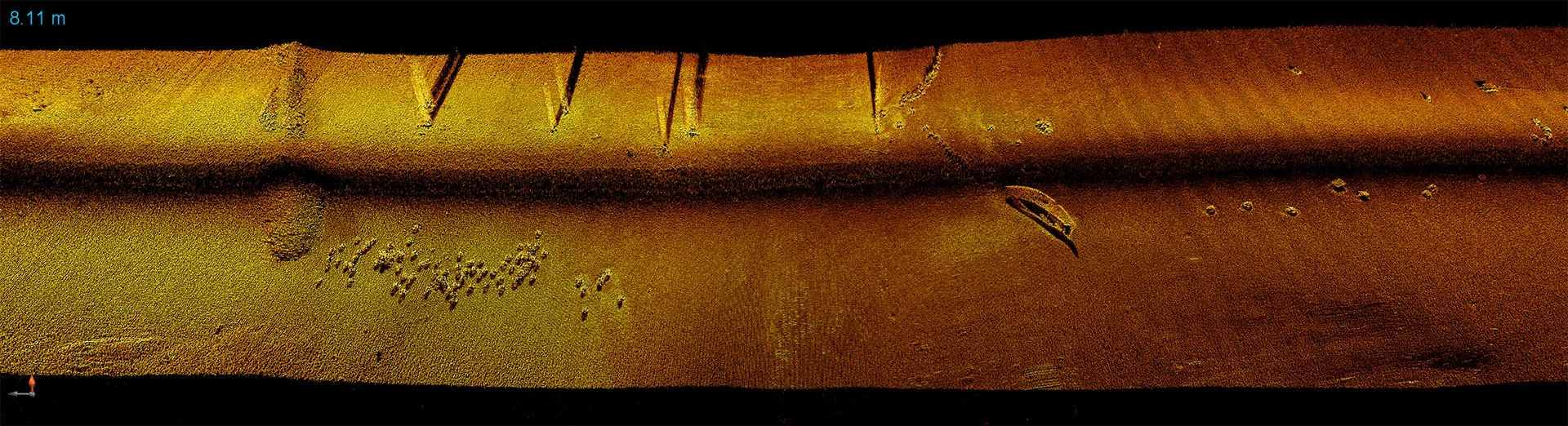
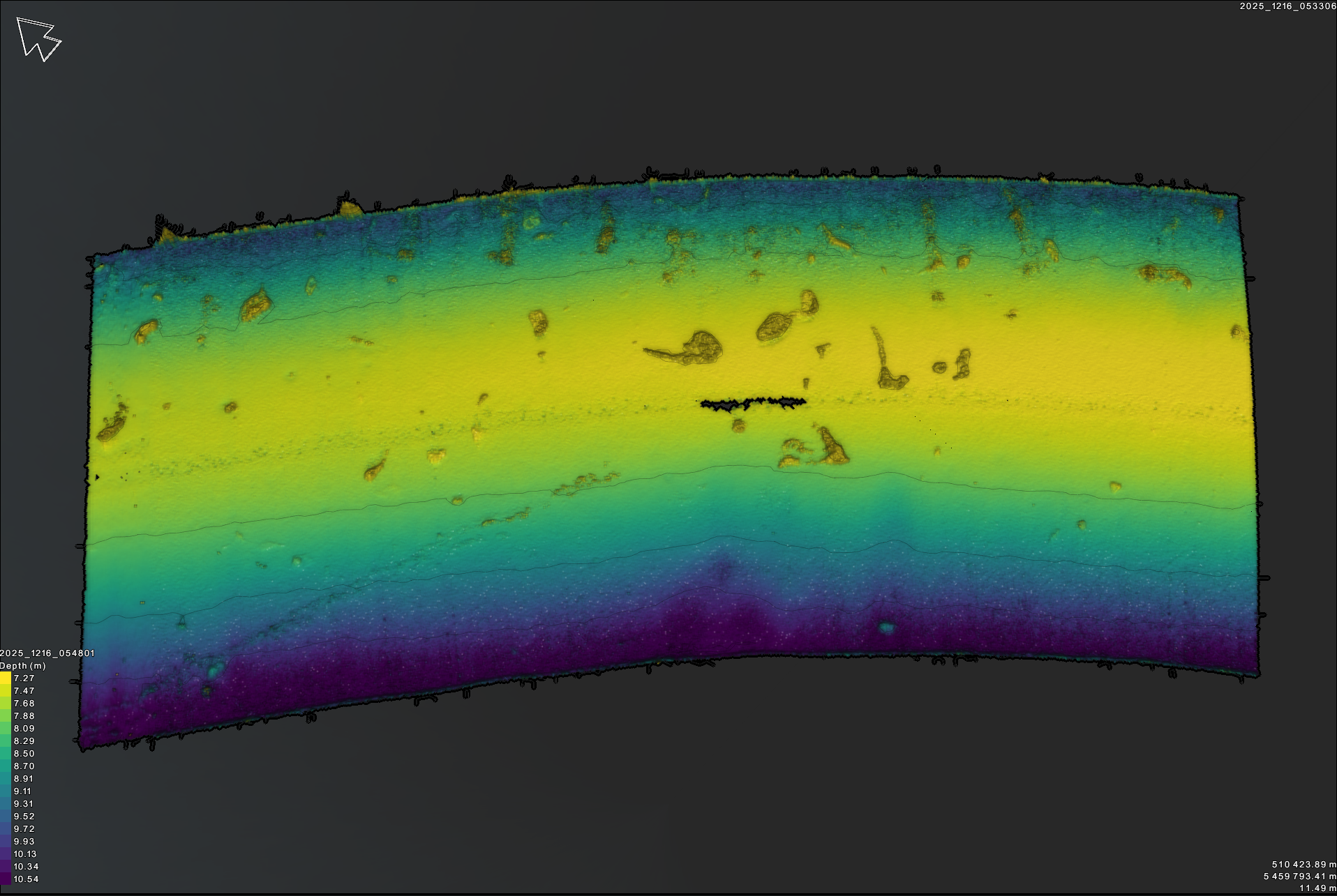
We generate detailed mosaics of substrate and structure types (sand, gravel, cobble, boulder, vegetation, and woody debris) that form critical fish habitats.
These data help identify spawning grounds, characterize benthic conditions, and guide restoration or permitting decisions.Sturgeon Recognition Surveys:
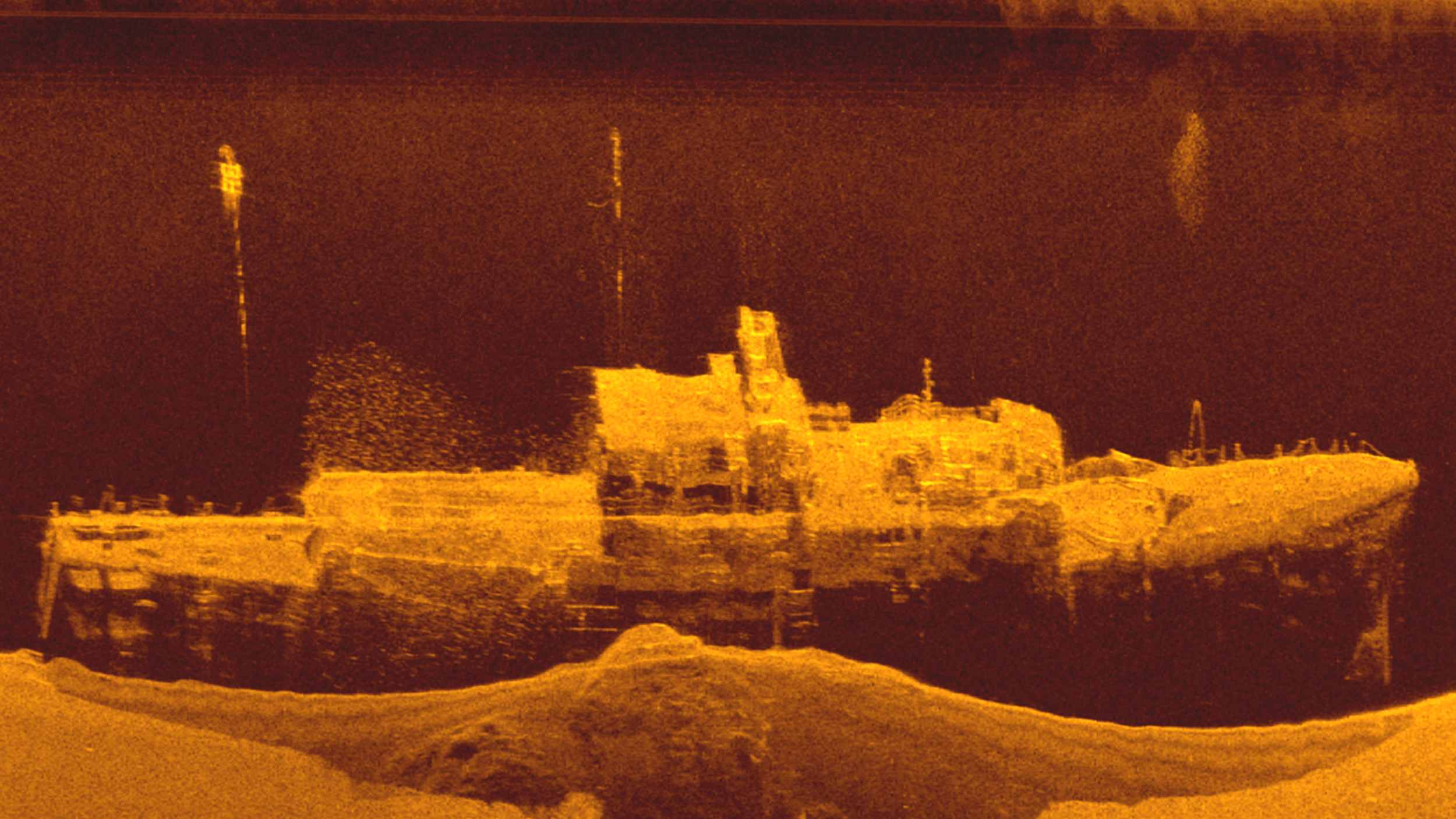
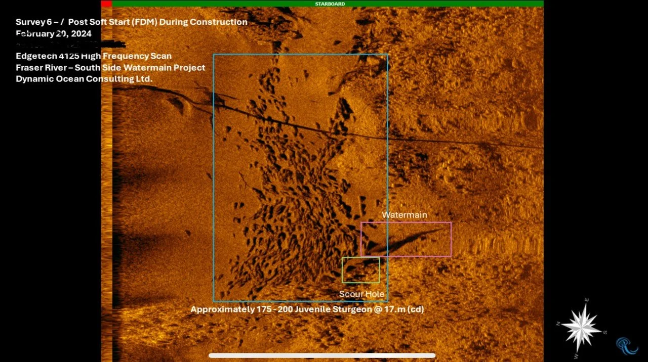
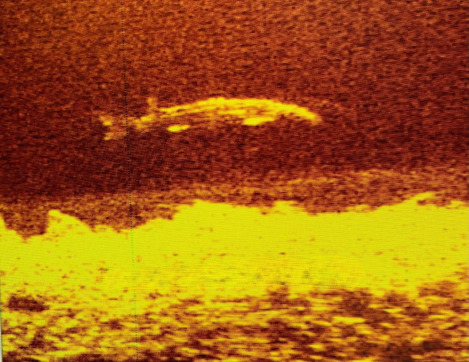
Following the Fraser River Sturgeon Conservation Society and Vancouver Fraser Port Authority methodologies, our surveys use dual-frequency sonar to locate and enumerate individual sturgeon without capture or disturbance.
Side-scan imaging provides real-time insight into sturgeon presence, behaviour, and habitat use around worksites such as dredging or pile-driving zones.Ghost Net and Debris Detection:
Lost or abandoned fishing gear—known as ghost gear—poses a serious ecological and navigational hazard, making up as much as 70% of floating marine debris worldwide. Using side-scan sonar, we locate, map, and document derelict gear and submerged debris for safe removal and reporting under Canada’s Ghost Gear Program.

Equipment and Capability
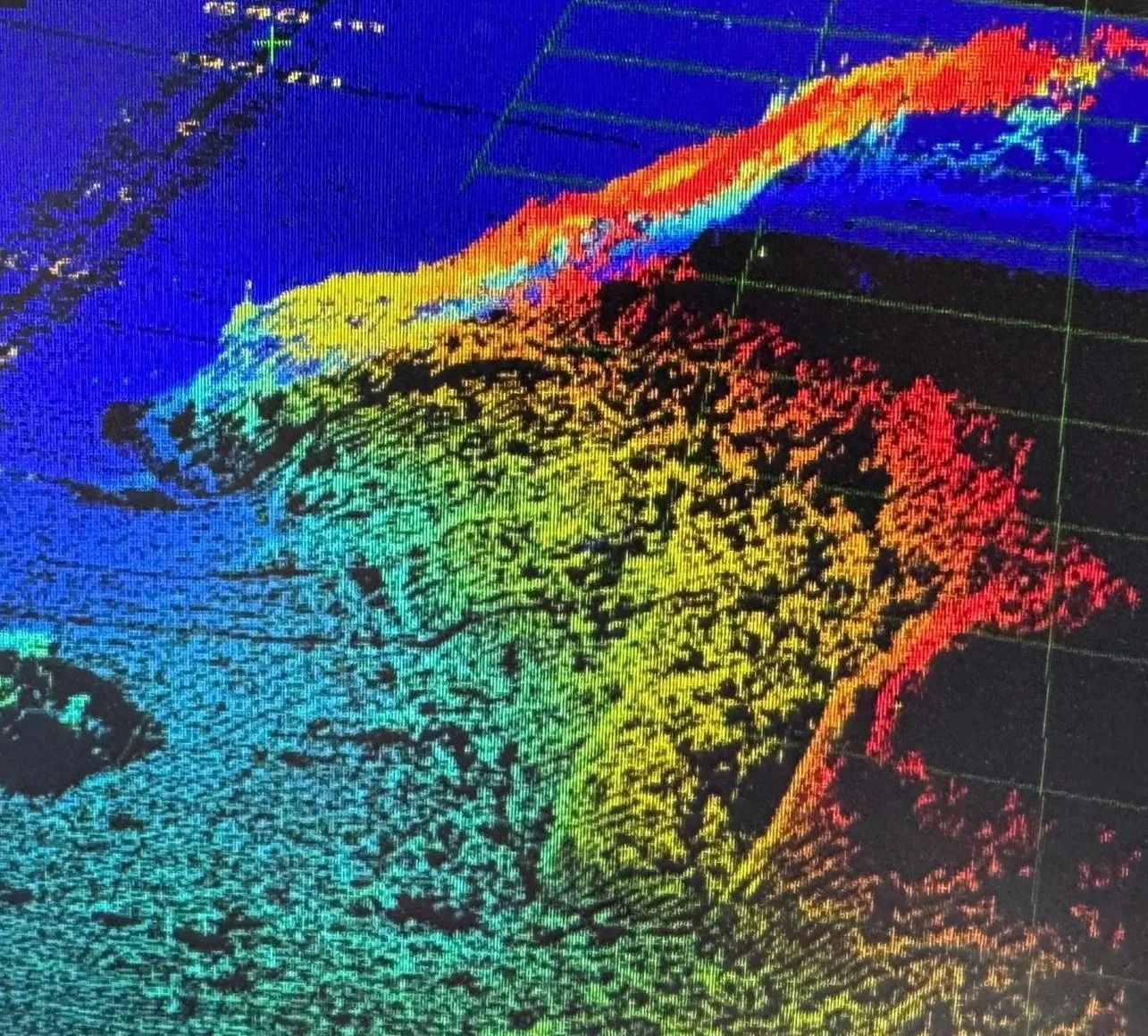
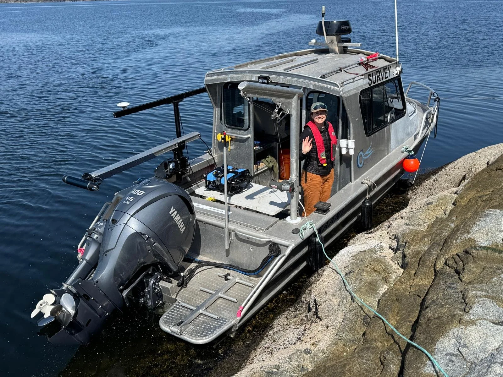
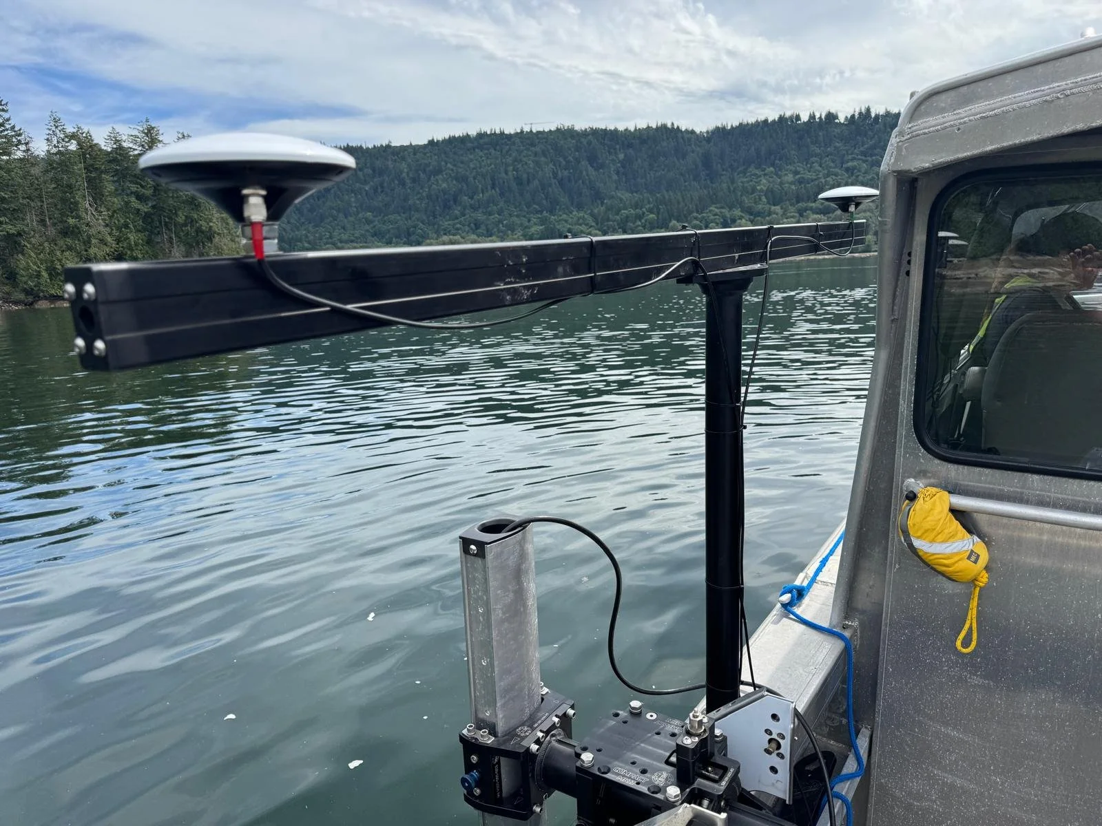
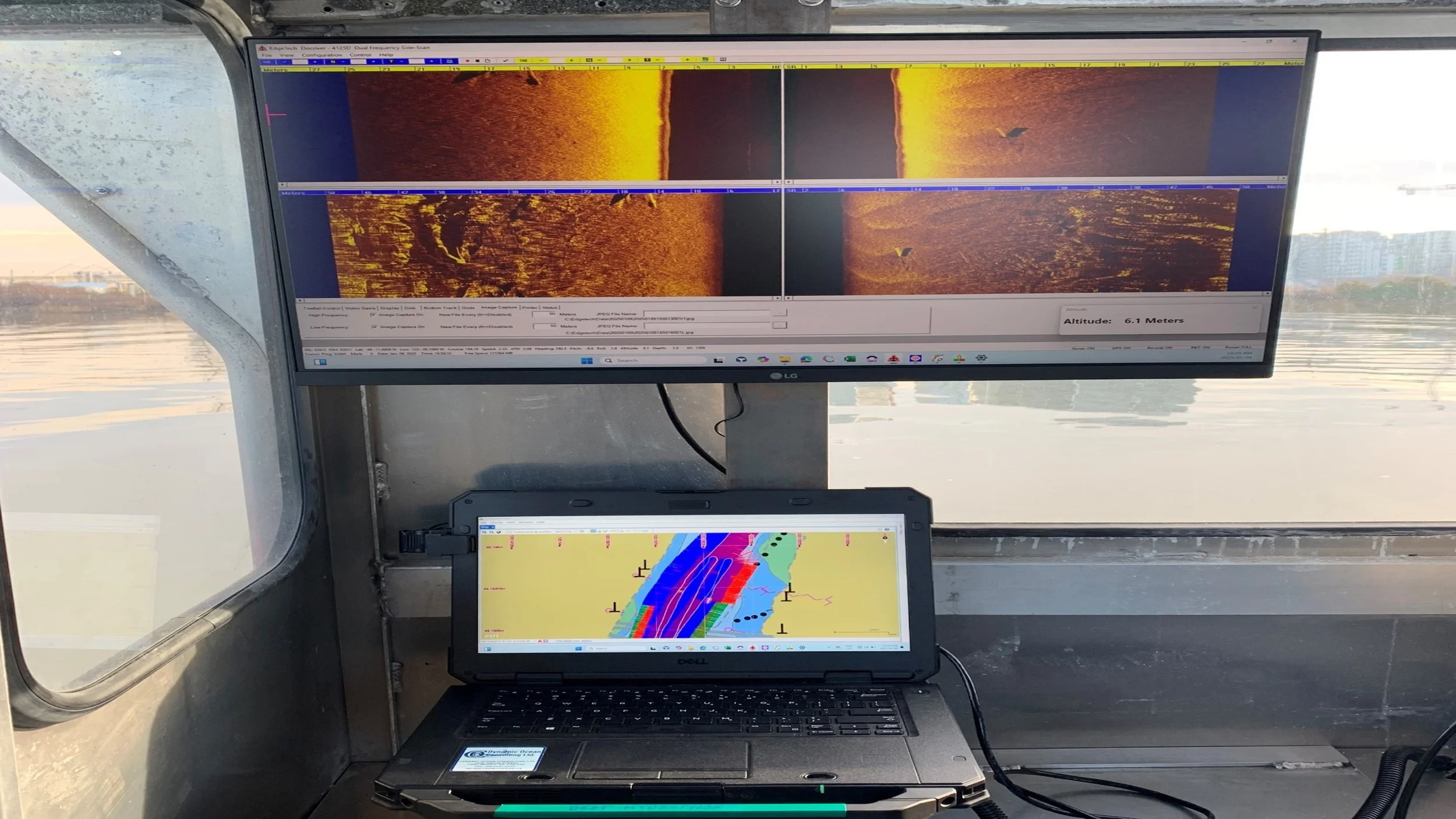
We deploy dual-frequency towfish and pole-mounted sonar systems integrated with full GNSS for high-precision positioning and repeatable coverage.
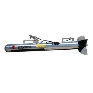
EdgeTech 4125i Dual-Frequency Side Scan Sonar
Operates at 600 kHz and 1,600 kHz, providing exceptional range (up to 50 m) and ultra-high-resolution imagery for fine-scale habitat or sturgeon detection.
Ideal for identifying fish, submerged structures, and subtle habitat features in both deep and shallow environments.
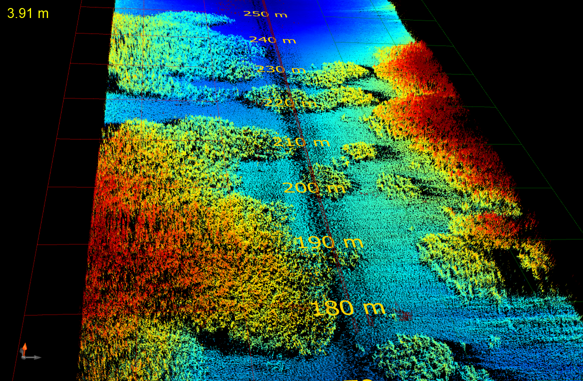
PingDSP 3DSS-iDX-450
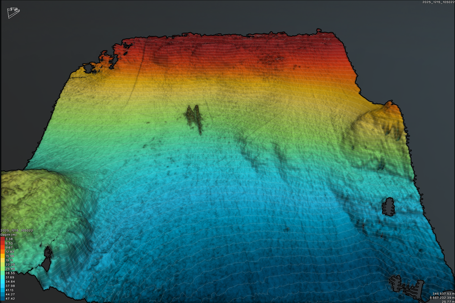
Produces true 3D imagery with wide swath coverage and real-time visualization of bottom morphology.
Excellent for complex riverbeds, underwater inspections, and high-accuracy volumetric mapping.
Pole-Mounted System
A Universal Sonar Mount enables stable, shallow-water deployment and rapid mobilization for nearshore, port, or small-craft operations.
GNSS Survey Integration
Our RTK/PPK GNSS system ensures centimetre-level positioning accuracy.
Real-time corrections (RTK) provide precise navigation, while post-processing (PPK) refines results for final mapping and reporting.
Deliverables
Geo-referenced sonar mosaics (GeoTIFF, shapefiles, or KMZ)
Substrate and habitat classifications
Target detection logs and coordinates
Imagery suitable for regulatory submission, visualization, and long-term monitoring
Why Dynamic Ocean Consulting?
Field-tested in Canadian coastal and riverine conditions
Fully insured and safety-compliant
Experienced operators with environmental and technical credentials
Proven track record supporting regulatory compliance, habitat restoration, and research applications
Contact us to discuss your project needs. Explore the links below to learn more about our specialized marine survey and field service capabilities.